V 1,2 Taberna
Description
Susanna Blåndman
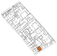
Taberna V 1,2 is located in the south part of insula V 1, at Via di Nola, close to the intersection with Via del Vesuvio. Taberna, V 1,1.32, is located immediately to the west and a smaller house, V 1,3, to the east of taberna V 1,2. The taberna is entered through a shopfront doorway from Via di Nola. The building measures almost 39 m2 and consists of three rooms, numbered 3, 4 and 5. Room 3 constitutes the southern half of the taberna and is the largest of the three rooms. Room 4 is located in the northeast corner and is entered from room 3. Room 5, located in the northwest corner, is also entered from room 3 and is the smallest of the rooms. An upper floor was located above room 4 and 5.
Among the more important findings in the taberna were a drain (room 5), a cistern (room 5), an elevated floor (room 3) and three stalls (room 3). The conclusion made from our documentation and excavation is that the taberna functioned as a fullonica. The three basins found along the west wall in room 3 can be identified as fulling stalls and the elevated floor in front of them as a work floor.
None of the stalls contained remains of the fulling tubs that most probably were installed in the stalls. If they were made of wood they are likely not to have survived. Fulling stalls and a work floor are both strong indications of a fullonica. The drain further strengthens the conclusion. In a conical hole between the south and the central fulling stall an amphora most probably was installed, containing detergents for a fulling process. Two low walls in room 3 can be identified as supporting walls for workers working in the fulling stalls. All the features are located in the west and northwest part of V 1,2, attesting that it was the main working area.
The southwest corner of insula V 1 was partly cleaned from eruption debris as early as April 1748, as part of the first excavation in Pompeii. The corner is visible in the plan by Baldwin and Cradock in 1832. No details for V 1,2 are drawn and it is not clear from the plan if the taberna was cleaned or not. In plans from the 1840s the south part of the insula is visible but it is difficult to discern any details. In a plan from 1852 by Zahn, the south part of the insula is drawn in more detail and V 1,2 can be discerned. The layout of the taberna is slightly different on different plans, for example in the plan from 1852 and in the plan by Overbeck in 1855 there seems to be a wall between room 3 and 5. This wall is not visible on any plans after 1855.
The first written account of taberna V 1,2 in the notes and publications from the excavations is made by Giuseppe Fiorelli in 1875, in his book Descrizione di Pompei. The description is short but refers to a fusorium, a small staircase or ladder to a mezzanine and an inner room with a window. The book contains a plan of the city showing that the south part of insula V has been cleaned from eruption debris but no separate houses are drawn on the map.
There is a short description of V 1,2 in Gebäudeverzeichnis und Stadtplan der antiken Stadt Pompeji. Eschebach's description of V 1,2 is short and mentions a guest room, to the left a podium for a table of wood and a podium for a staircase to the upper floor, to the right a no longer existing fusorium and behind them a kitchen with a hearth and a latrine and to the right a cubiculum with a window towards the shop. According to Eschebach the taberna was excavated in 1748 and in 1836. No written records of the excavations seem to exist. The neighbouring taberna, V 1,1.32, was also excavated in 1748 and is mentioned in Pompeianum Antiquitatum Historia according to Eschebach, but there is no mention of V 1,2. The map attached in the book by Eschebach is detailed and in contradiction to earlier plans it shows a doorway between V 1,2 and V 1,1.32. Two features are visible in the plan along the west wall of room 3 and one feature is visible in the northeast corner in room 5. According to Eschebach the neighbouring taberna is called Thermopolium des Fortunatus and V I,2 is named, with uncertainty, Caupona des Fortunatus.
A short description of V 1,2 and a plan of the insula is published in Corpus Topographicum Pompeianum from 1986. No doorway is marked between V 1,2 and V 1,1.32 and the authors mention that a non-existent doorway has been drawn on the map made by Eschebach. Two features along the west wall of room 3 and a feature in the northeast corner of room 5 are visible on the plan. The description mentions that a window in the back room has been delineated and that the fusorium in the northeast corner no longer is visible.
In the book The world of Pompeii, edited by John Dobbins and Pedar W. Foss, the city plan does not show any doorway between the two tabernae and the features visible in V 1,2 are the earlier mentioned features along the west wall of room 3.
Miko Flohr investigated part of the taberna in 2008 as part of a larger project called Cleaning the Laundries. He conducted several field campaigns in Pompeii, published as three reports of which Cleaning the Laundries III. Report of the 2008 campaign contains information about V 1,2. In 2013 he released the book The World of the Fullo. Work, Economy and Society in Roman Italy which briefly discuses taberna V 1,2.
In 2010 and 2011 the taberna was cleaned and documented by members in The Swedish Pompeii Project. Flohr's conclusion that the taberna functioned as a fullonica, a taberna used for fulling to polish and renew clothes or garments, seems to hold and Eschebach's assumption that it was a caupona is erroneous. From Fiorelli's description it is clear that he saw the taberna as a shop, but without closer definition.
Bibliography
CTP III 3A, H. B. van der Poel, L. GarcÃÂa y GarcÃÂa, J. McConnell, Corpus topographicum Pompeianum. P. 3 A, The insulae of regions I-V, Rome 1986.
J. J. Dobbins and P. W. Foss, The world of Pompeii, London 2007.
H. Eschebach, L. Eschebach, Gebäudeverzeichnis und Stadtplan der antiken Stadt Pompeji, Köln 1993.
G. Fiorelli, Descrizione di Pompei, Napoli 1875.
M. Flohr, »Cleaning the laundries, report of the 2006 season«, RivStPomp 18, 131-136.
M. Flohr, »Cleaning the Laundries III. Report of the 2008 campaign«, FOLD&R 214:1-14.
M. Flohr, The World of the Fullo: work economy and society in Roman Italy, Oxford 2013.
M. Flohr, »The textile economy of Pompeii«, JRA 26, 53-78.
T. Staub, The Casa del Torello di Bronzo (V 1,7) in Pompeii: investigating a residential house and its complex water system, Stockholm 2013.
Measurements and elevations
For the elevations the reference point SAP036 has been used. The reference point, located in the intersection between Via del Vesuvio and Via di Nola just outside V 1, 1.32, have the coordinates X (east / west) 2476632,928, Y (north) 4511318,449 and Z (elevation) 31.912 metres above sea level.
Since a five metre long levelling rod was used to measure both the height of the walls and the elevation measurements, the measurements are given in metres with two decimals. For the length of walls and features a 20 metre long measuring-tape was used.
Abbreviations:
H - height, L - length, Wi - Width, S - south, N - north, E - east, W - west and m.a.s.l. - metres above sea level.