Location
Location
Thomas Staub
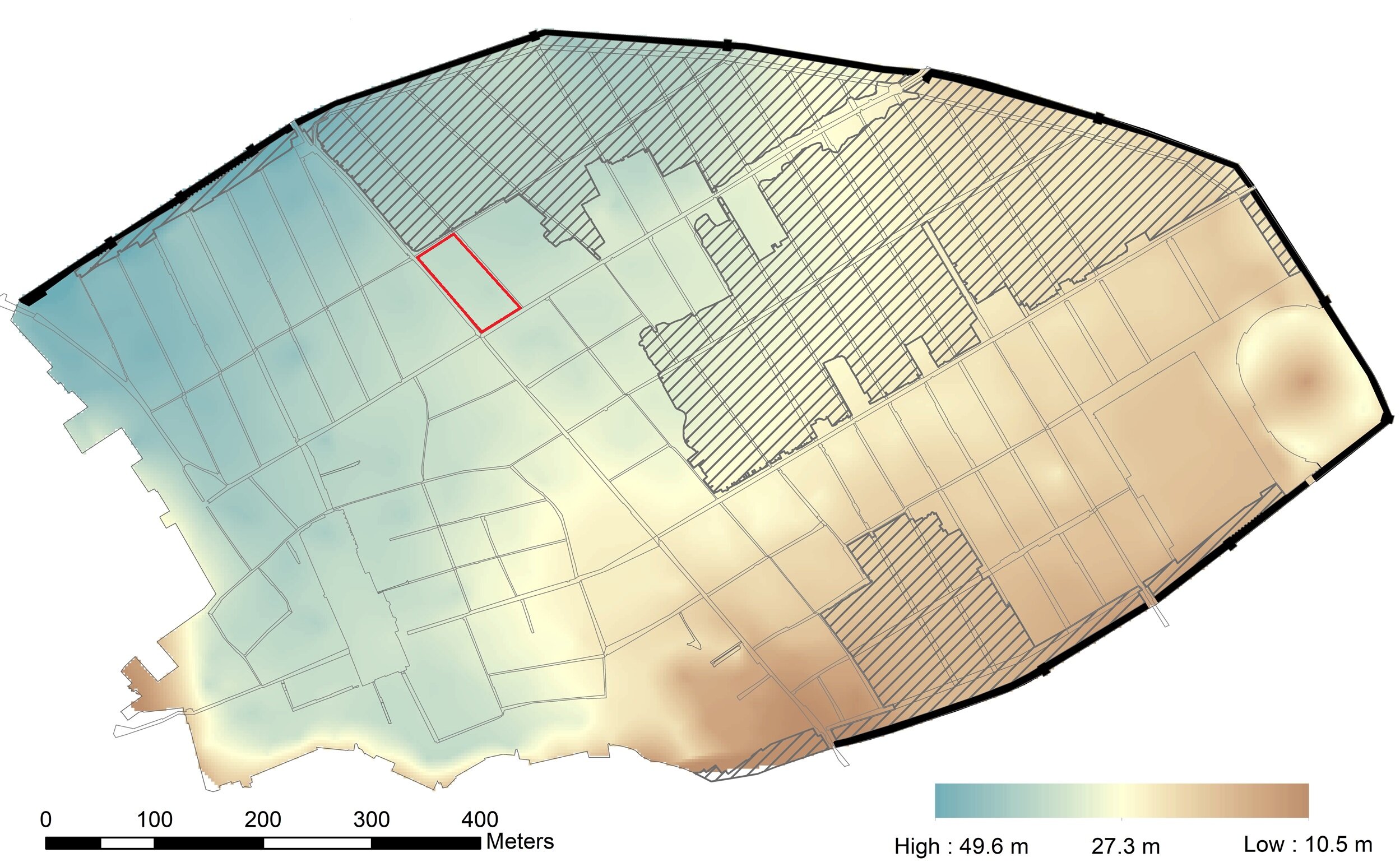
Situated in the northern part of the volcanic plateau on which the city of Pompeii stands, this city-block occupies high ground on the north-south sloping hillside, far above the southern part of the town. The height difference between (c. 26 m) the northwest corner of Insula V 1 on the Via del Vesuvio (34.9 masl) and the southern city gate, Porta di Stabia (9.15 masl), the exit point of this main thoroughfare, is remarkable (height measurements from https://digitalhumanities.umass.edu/pbmp/ , the Pompeii Bibliography and Mapping Project). Between the highest point of the city, Porta Vesuvio and the south-west corner of our insula, the terrain drops from 41.2 to 32.05 masl. There are also perpendicular height differences: thus Via del Vesuvio forms a natural course for pluvial waters.
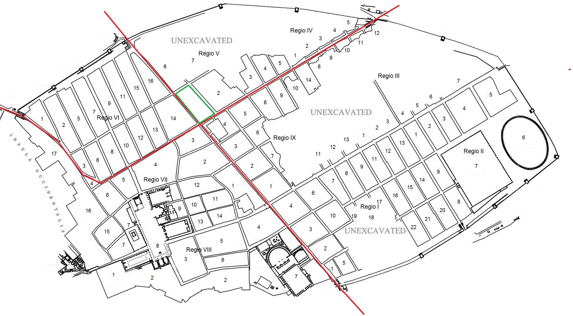
The insula has a size of c. 3600 m2. It faces two major Pompeian thoroughfares, the north-south communicating axis Via del Vesuvio/di Stabia and the east-west axis, Via Consolare/Fortuna/Nola, the northernmost of the city’s two east-west thoroughfares. This situation, the vicinity to one of the city-gates (Porta Vesuvio, only 240 m further north) and the relative proximity to the city centre, the Forum, endorsed this insula with an attractive position, not least for business and commerce. Indeed, we find quite a large number of commercial establishments lining the two arteries. Instead, towards the smaller streets – Vicolo delle Nozze d’Argento to the north and Vicolo di Cecilio Giocondo to the east – entrances are scarce.